This first section runs almost entirely along the Camí de Cavalls and passes through notable places such as Sa Mesquida, the Parc Natural de s’Albufera des Grau, the Favàritx area, and Port d’Addaia.
Camí de Cavalls 360º offers a mountain bike route around Menorca inspired by the Camí de Cavalls and adapted to maximize enjoyment on two wheels. It is an exhilarating route with short but intense uphills and downhills. The rugged terrain of the Menorcan coast gives it great appeal and high difficulty. Hardness and fun are guaranteed.
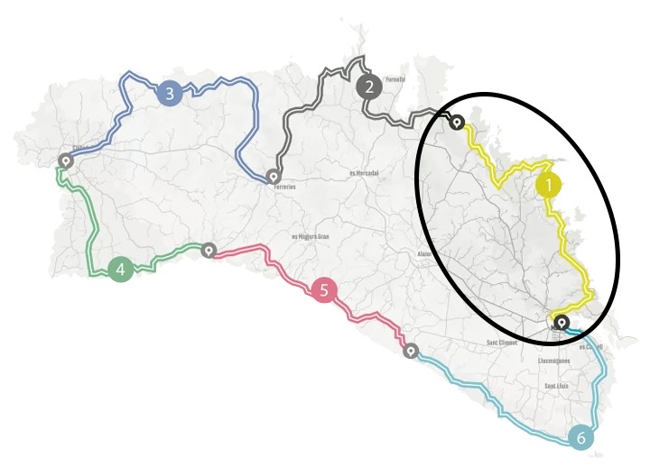
The route has three options (Standard, Plus, Basic) to suit the participants’ level. It can also be divided into three to six stages, depending on the pace and availability of time. The MTB 6 stages option is a favorite that suits a wider range of cyclists. However, it requires a physical and technical base that allows participants to tackle a much tougher and more demanding route than its total figures of over 190 kilometers and almost 2,500 meters of elevation suggest.
With Camí de Cavalls 360º, participants only have to think about biking and enjoying the landscapes and scenery. The organization team takes care of the rest: advice on the route and its variants, logistical issues, and even transfers to accommodations when necessary.
STAGE #01: MAÓ – ARENAL D’EN CASTELL
STAGE #02: ARENAL D’EN CASTELL – FERRERIES
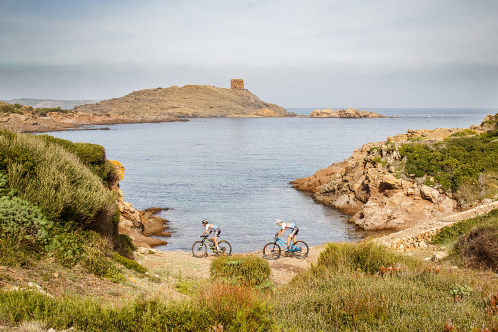
STAGE #03: FERRERIES – CIUTADELLA
STAGE #04: CIUTADELLA – CALA GALDANA
STAGE #05: CALA GALDANA – CALA EN PORTER
STAGE #06: CALA EN PORTER – MAÓ
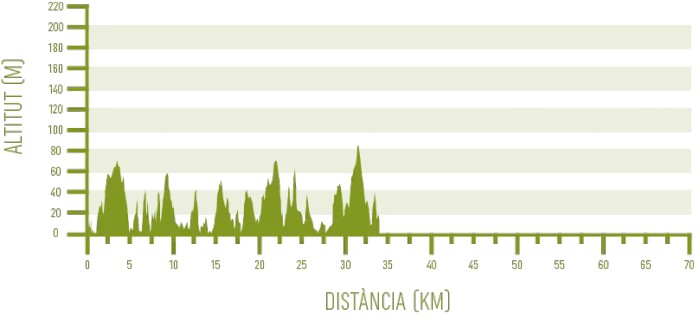
Distance: 35,00 km / Elevation gain: 630 m
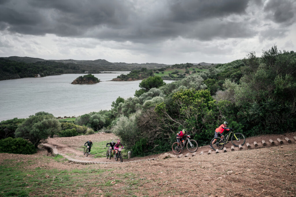
The first stage of the route links Maó with Arenal d’en Castell, through the northeastern sector of Menorca. The stage runs almost entirely near the coast and crosses some of the island’s most emblematic landscapes, such as the Parc Natural de s’Albufera des Grau, the Favàritx area, and Port d’Addaia.
From Maó to Es Grau
The start of this first stage is located in the port of Maó, specifically in the Pla de Baixamar. From the port area, it heads towards the GR 223 Camí de Cavalls. The first six kilometers are on paved roads, until Cala Mesquida.
Next, it enters a section through a very characteristic Menorcan landscape, where you can see the socarrells, thorny cushion-shaped shrubs. Special attention should be paid to three very demanding climbs, coinciding with the Raconada de sa Mesquida Vella, the Macar de Binillautí, and the Caleta de Binillautí.
Later, within the Parc Natural de s’Albufera des Grau, it connects with the Me-5 road, which leads to Es Grau.
From Es Grau to Favàritx
Before reaching the town of Es Grau, the path turns left through an area of great scenic value, the Albufera des Grau, which is the core zone of the Biosphere Reserve. It is also a fairly flat section, allowing for a breather, until the beach of Es Grau. The terrain becomes hilly again, although not as steep as the previous uphills.
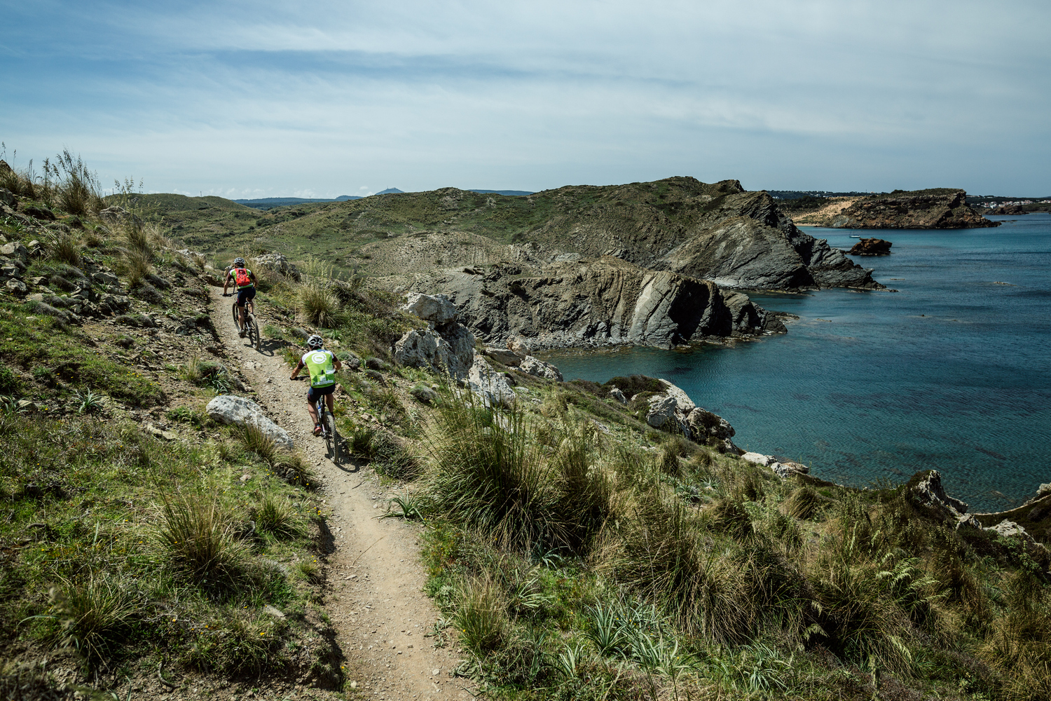
The itinerary alternates small coves such as Cala des Tamarells and Cala Rambles, with the Illa d’en Colom offshore. After an inland section and several more coves, it reaches Platja d’en Tortuga, the most interesting part of this section, offering beautiful views of Cap de Favàritx and its lighthouse.
The Camí de Cavalls crosses the beach before facing a short but intense climb. A flat kilometer leads to the Cf-1 road, which to the right, would take you to the Far de Favàritx lighthouse.

From Favàritx to Arenal d’en Castell
The route, however, follows the Cf-1 road to the left, and turns right 1.8 kilometers further on through a Camí de Cavalls’ gate. A brief climb through farmland culminates at the high point of Es Pou d’en Caldes. The views of Mongofra, Addaia, and Na Macaret are magnificent.
The downhill to Es Pou d’en Caldes is a fun trail with a lot of flow and a couple of small more challenging sections. Next is quite rugged terrain, with two short but very steep climbs with little traction around Marina de Mongofra.
You can catch your breath once you reach Camí d’Addaia, a wide and flat track that borders the Salines de Mongofra and Port d’Addaia. With just a bit of attention, you can see a great variety of birds in this area.
The final part of the stage includes one last strong climb to a wide path leading to the Addaia residential area. To reach the end of the day in Arenal d’en Castell, you need to follow paved roads and streets.