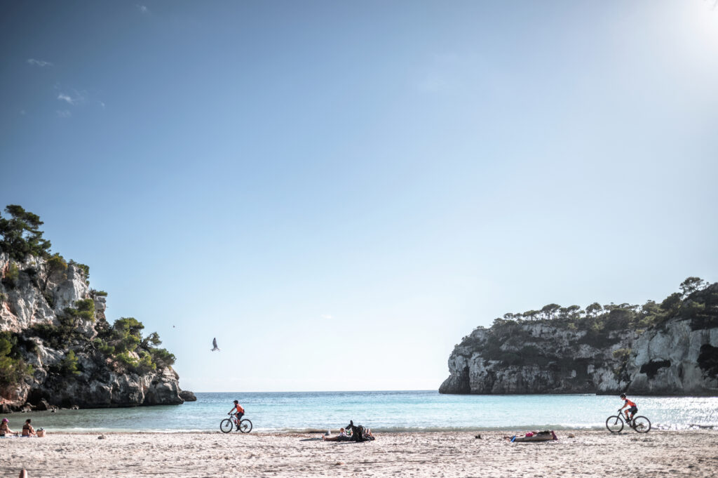
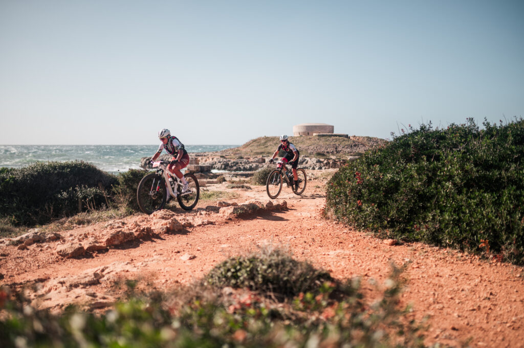
This stage features minimal elevation gain, but that doesn’t mean it’s easy, especially the first half. It runs through Menorca’s limestone platform, and bikers will need to stay focused and put their technical skills to the test as they ride over the rocky terrain.
Camí de Cavalls 360º offers a mountain bike route around Menorca inspired by the Camí de Cavalls and adapted to maximize enjoyment on two wheels. It is an exhilarating route with short but intense uphills and downhills. The rugged terrain of the Menorcan coast gives it great appeal and high difficulty. Hardness and fun are guaranteed.
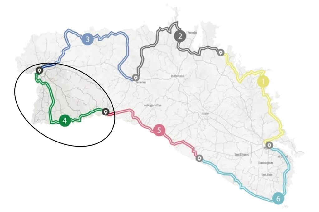
The route has three options (Standard, Plus, Basic) to suit the participants’ level. It can also be divided into three to six stages, depending on the pace and availability of time. The MTB 6 stages option is a favorite that suits a wider range of cyclists. However, it requires a physical and technical base that allows participants to tackle a much tougher and more demanding route than its total figures of over 190 kilometers and almost 2,500 meters of elevation suggest.
With Camí de Cavalls 360º, participants only have to think about biking and enjoying the landscapes and scenery. The organization team takes care of the rest: advice on the route and its variants, logistical issues, and even transfers to accommodations when necessary.
STAGE #01: MAÓ – ARENAL D’EN CASTELL
STAGE #02: ARENAL D’EN CASTELL – FERRERIES
STAGE #03: FERRERIES – CIUTADELLA
STAGE #04: CIUTADELLA – CALA GALDANA
STAGE #05: CALA GALDANA – CALA EN PORTER
STAGE #06: CALA EN PORTER – MAÓ
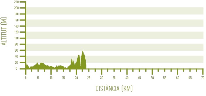
Distance: 31,00 km / Elevation gain: 137 m
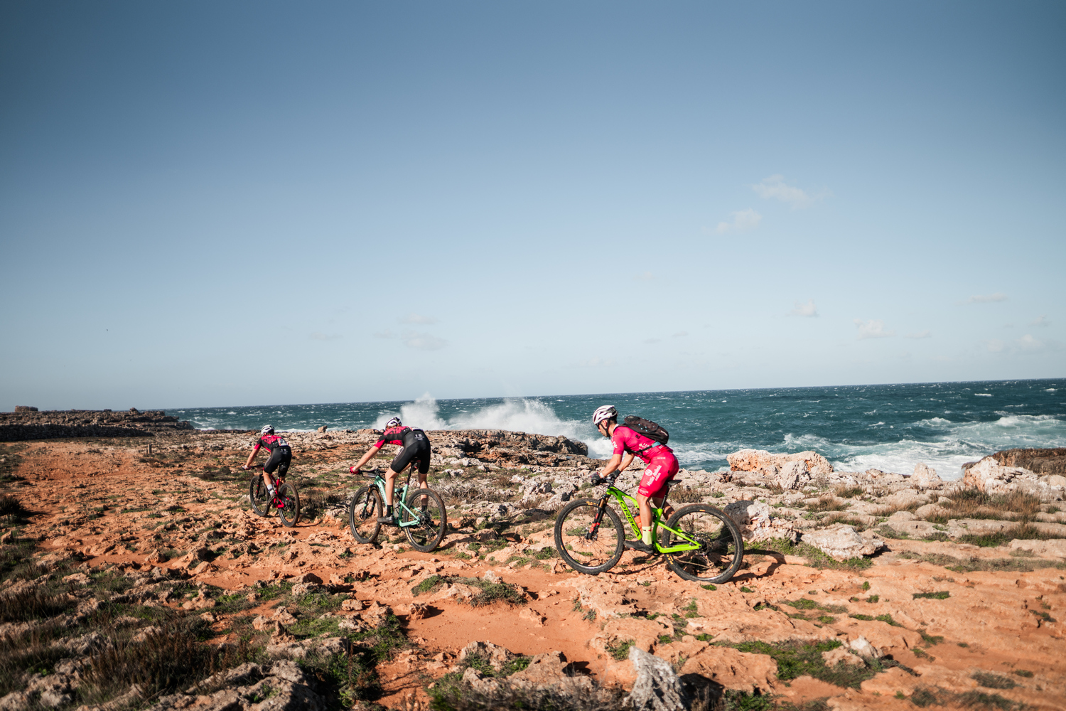
The fourth stage of the route is a real challenge for bikers. There are no significant uphills or downhills, but it’s tough to even make two pedal strokes in a row due to the very rocky and uneven ground in some sections. This is the limestone platform of the northwest and south of Menorca, which gives this section of the Camí de Cavalls its unique character.
From Ciutadella to Son Saura
This is the longest stretch of the stage, covering two-thirds of the day’s total distance. It alternates between paved sections in residential areas and others on natural terrain. Participants opting for the Plus route will stay entirely on the Camí de Cavalls, while the Standard route avoids a couple of particularly technical sections by diverting through easier inland paths.
From Ciutadella, the GR heads south through a series of urbanized coves: Sa Caleta, Santandria, and Cala Blanca. The trail then runs along rocky coastline through a demanding and rocky terrain that stretches to the Cap d’Artrutx residential area.
The Far d’Artrutx lighthouse marks the southwestern tip of the island. Menorca’s southern coast is rocky, technical, and highly demanding. It starts, however, in the Cala en Bosc residential area before entering natural terrain near the Son Xoriguer residential area. From here, the route goes through a succession of small coves leading to the larger Platges de Son Saura beaches: Platja des Banyul and Platja de Bellavista.
The Basic route, meanwhile, avoids this entire section, replacing it with an easy track that runs almost entirely on paved roads, offering a chance to discover the rural inland south of Ciutadella.
From Son Saura to Cala en Turqueta
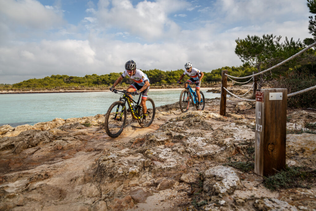
All three routes converge again at the wooden walkway that crosses Platja de Bellavista, the second of Platges de Son Saura beaches. This is the first glimpse of the iconic landscapes of Menorca’s southern coast, with its white sand and crystal-clear waters, surrounded by pine groves and limestone cliffs.
From Son Saura, the coves come one after another. First is Cala des Talaier, followed by Cala en Turqueta. The terrain is extremely rocky, with a very technical section where the route climbs to the area of the Cova des Moro before descending into Cala en Turqueta for the Plus route.
Between Cala des Talaier and Cala en Turqueta, the Basic and Standard routes take an alternative path that moves a few meters away from the coast. The technical difficulties are concentrated in the flatter areas, while the uphill and especially the final downhill are more manageable.
From Cala en Turqueta to Cala Galdana
The final 5.5 km include almost all the elevation gain of the stage and run entirely along the Camí de Cavalls. There are still some rocky sections, but the most demanding parts of the day are behind you. The route doesn’t follow the coastline directly but instead goes through coastal forests.
There are still plenty of attractions. About halfway along, roughly 150 meters off the route, is Macarelleta, one of Menorca’s most famous coves. A technical uphill and downhill on a rocky trail with some tricky sections connect to Macarella, the bigger sister of Macarelleta.
After crossing this second cove over the sand, you face a highly challenging uphill next to a wooden stair, where you’ll need to push your bike. The final part, leading to Cala Galdana, is a wide track that finishes with a downwards single track offering views of the sea.