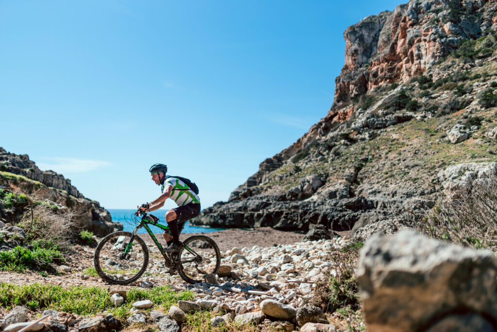
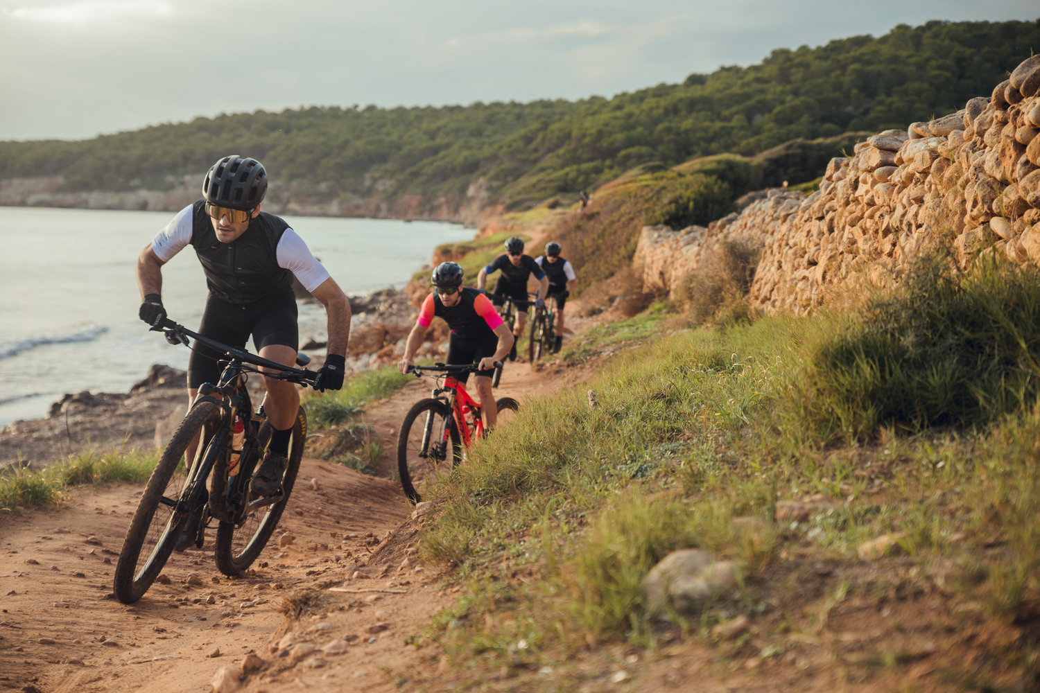
This stage features the most significant elevation gain along Menorca’s southern coast. Participants will go through forests, farmland, ravines, and iconic beaches such as Cala Mitjana, Binigaus, and Son Bou. The residential areas of Sant Tomàs, Son Bou, and Cala en Porter serve as key reference points.
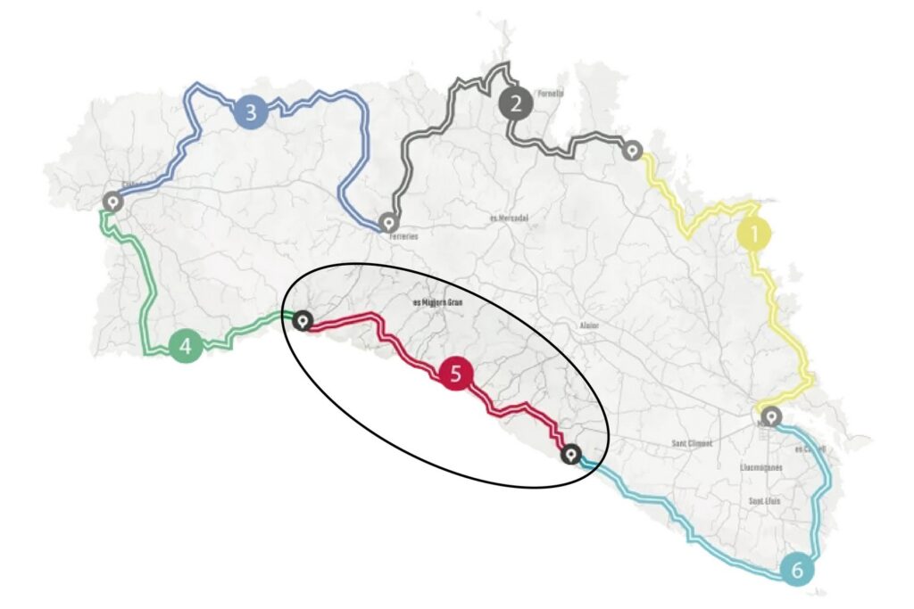
Camí de Cavalls 360º offers a mountain bike route around Menorca inspired by the Camí de Cavalls and adapted to maximize enjoyment on two wheels. It is an exhilarating route with short but intense uphills and downhills. The rugged terrain of the Menorcan coast gives it great appeal and high difficulty. Hardness and fun are guaranteed.
The route has three options (Standard, Plus, Basic) to suit the participants’ level. It can also be divided into three to six stages, depending on the pace and availability of time. The MTB 6 stages option is a favorite that suits a wider range of cyclists. However, it requires a physical and technical base that allows participants to tackle a much tougher and more demanding route than its total figures of over 190 kilometers and almost 2,500 meters of elevation suggest.
With Camí de Cavalls 360º, participants only have to think about biking and enjoying the landscapes and scenery. The organization team takes care of the rest: advice on the route and its variants, logistical issues, and even transfers to accommodations when necessary.
STAGE #01: MAÓ – ARENAL D’EN CASTELL
STAGE #02: ARENAL D’EN CASTELL – FERRERIES
STAGE #03: FERRERIES – CIUTADELLA
STAGE #04: CIUTADELLA – CALA GALDANA
STAGE #05: CALA GALDANA – CALA EN PORTER
STAGE #06: CALA EN PORTER – MAÓ
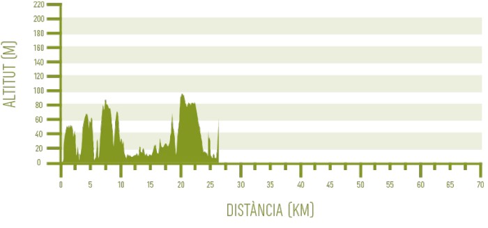
Distance: 28,00 km / Elevation gain: 437 m
Although the technical difficulty is generally moderate in this fifth stage, bikers will need to push themselves hard to overcome some challenging points due to elevation gain. Ravines shape the terrain, with steep uphills and downhills, most of which are manageable from a technical perspective… with a few surprises along the way.
From Cala Galdana to Sant Tomàs
The longest and most elevation-heavy section of the stage begins in Cala Galdana with an uphill road segment outside the Camí de Cavalls to avoid a staircase climb on foot. Once it reconnects with the historic trail, it stays on it until the stage’s end.
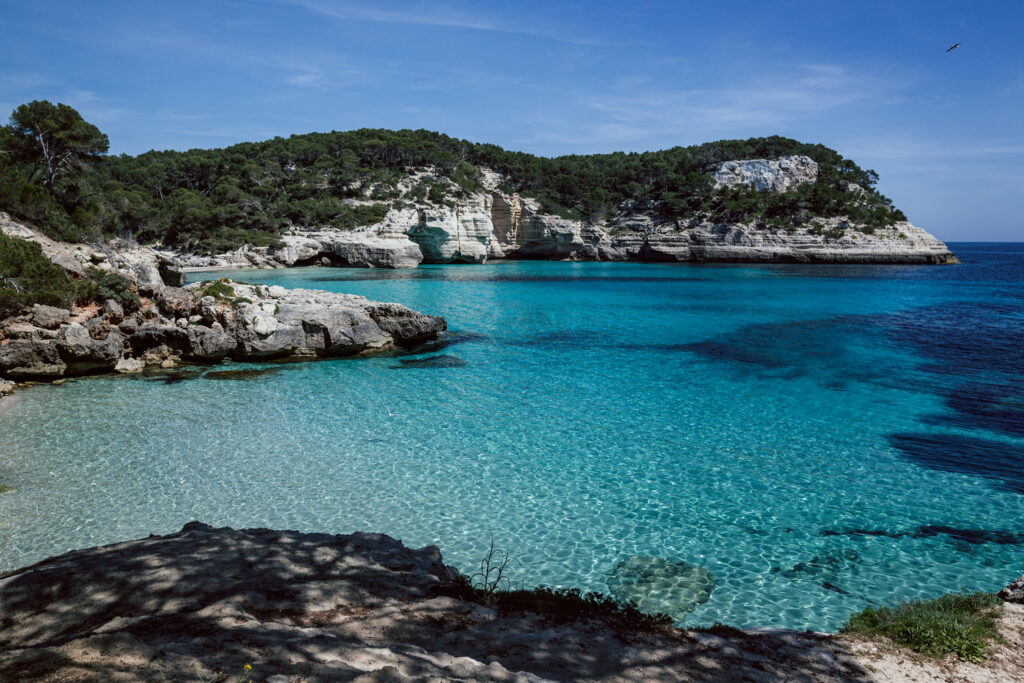
Just a kilometer and a half after leaving Cala Galdana, the route brings bikers to Cala Mitjana, a picturesque beach typical of southern Menorca, with white sand and clear waters, surrounded by forests that nearly reach the shore.
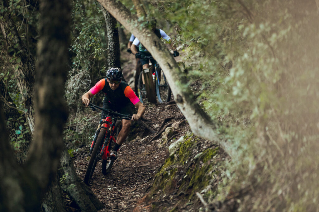
From here, the Camí de Cavalls moves away from the coast, crossing forests, farmland, and ravines. In less than eight kilometers between Cala Mitjana and Binigaus, much of the southern coast’s elevation is concentrated. These paths, however, are less rocky than in previous stages, allowing for more comfortable riding. The ups and downs are shaped by ravines such as Trebalúger, Sa Cova, and Sa Torre.
The rollercoaster terrain ends when the trail reaches the coastline again at Platja de Binigaus, where a flatter section of Menorca’s southern coast begins. This beach, with its wide stretch of white sand and turquoise waters, is one of the largest unspoiled beaches in the south.
The last kilometer to Sant Tomàs offers stunning sea views, providing an extra incentive before reaching the residential area.
From Sant Tomàs to Son Bou
The section between Sant Tomàs and Son Bou is short and fast, covering less than seven kilometers with minimal elevation. Part of it runs on asphalt through developed areas. It begins by following the Sant Tomàs promenade to the dock at the far end. Here, the rocky terrain resumes, and there may be spots where carrying the bike is necessary during the uphill.
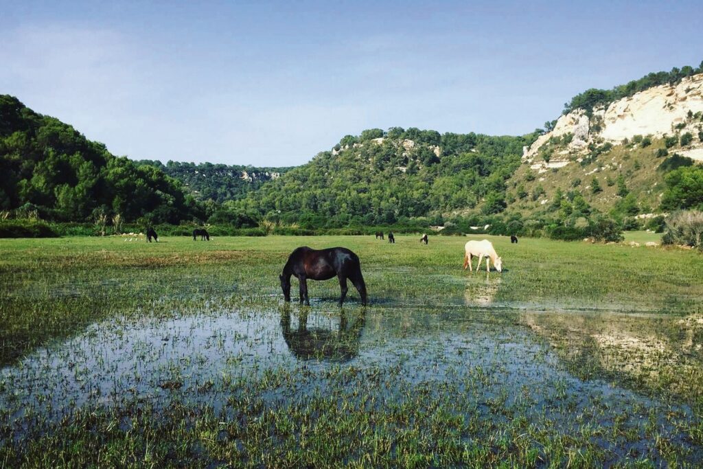
The trail soon becomes smoother, passing through farmland until it reaches Platja de Talis, which marks the beginning of Son Bou’s extensive sandy beach. The Camí de Cavalls turns inland, skirting the Prat de Son Bou wetlands and crossing two ravines that feed this area: Son Boter and des Bec.
Before long, bikers will reach the residential area of Son Bou, which must be crossed from end to end before exiting at the far side. Here, riders can visit the remains of a 5th-century Paleochristian basilica.
From Son Bou to Cala en Porter
The initial part of this section is the only stretch in the stage where the Basic route differs from the Standard and Plus routes. The latter two follow the Camí de Cavalls, leaving Son Bou via a technical uphill climb. At the top, it’s worth taking a 500-meter detour to Cap de ses Penyes for breathtaking views of the southern coast, especially the Son Bou beach.
Next, the track goes down to Cala de Llucalari, located at the bottom of the ravine of the same name. The climb on the other side is steep and highly technical, requiring much of it to be done on foot. Afterward, the trail eases up, transitioning to an old paved road and a wide dirt track through farmland.
The Basic route, meanwhile, adds about three extra kilometers, most of which are on asphalt. This detour avoids the Barranc de Llucalari area and rejoins the other routes on the wide track.
From there, the Camí de Cavalls heads toward the descent into the Barranc de Cala en Porter, the longest ravine on the island. This downhill is relatively smooth, on a wide path with few challenges. Inside the ravine, bikers face one last steep uphill climb, requiring the bike to be pushed again.
At the back of the cove, just before reaching the sea, the trail diverts through the steep streets of the Cala en Porter residential area, where the stage ends with a tough uphill finish.
